


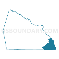
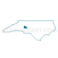
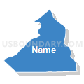
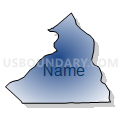
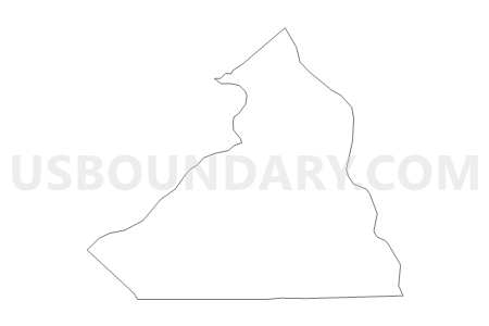
Voting District 22, Rowan County, North Carolina
About
Outline

Summary
| Unique Area Identifier | 641345 |
| Name | Voting District 22 |
| County | Rowan County |
| State | North Carolina |
| Area (square miles) | 34.70 |
| Land Area (square miles) | 32.80 |
| Water Area (square miles) | 1.90 |
| % of Land Area | 94.53 |
| % of Water Area | 5.47 |
| Latitude of the Internal Point | 35.53533110 |
| Longtitude of the Internal Point | -80.25404290 |
Maps

Graphs
Select a template below for downloading or customizing gragh for Voting District 22, Rowan County, North Carolina


Neighbors
Neighoring Voting District (by Name) Neighboring Voting District on the Map
- Voting District 0017, Stanly County, NC
- Voting District 0018, Stanly County, NC
- Voting District 07-00, Cabarrus County, NC
- Voting District 18, Davidson County, NC
- Voting District 23, Rowan County, NC
- Voting District 25, Rowan County, NC
- Voting District 56, Davidson County, NC
- Voting District ELD, Montgomery County, NC
Top 10 Neighboring County Subdivision (by Population) Neighboring County Subdivision on the Map
- Harris township, Stanly County, NC (6,480)
- Morgan township, Rowan County, NC (3,424)
- Healing Spring township, Davidson County, NC (2,642)
- Eldorado township, Montgomery County, NC (1,873)
- Township 7, Gold Hill, Cabarrus County, NC (1,431)
- Jackson Hill township, Davidson County, NC (1,107)
- Alleghany township, Davidson County, NC (710)
Top 10 Neighboring Unified School District (by Population) Neighboring Unified School District on the Map
- Cabarrus County Schools, NC (155,489)
- Rowan-Salisbury Schools, NC (130,380)
- Davidson County Schools, NC (127,662)
- Stanly County Schools, NC (60,585)
- Montgomery County Schools, NC (27,798)
Top 10 Neighboring State Legislative District Lower Chamber (by Population) Neighboring State Legislative District Lower Chamber on the Map
- State House District 83, NC (84,327)
- State House District 80, NC (78,723)
- State House District 67, NC (75,179)
- State House District 76, NC (71,116)
Top 10 Neighboring State Legislative District Upper Chamber (by Population) Neighboring State Legislative District Upper Chamber on the Map
- State Senate District 36, NC (210,610)
- State Senate District 33, NC (189,009)
- State Senate District 34, NC (179,668)
- State Senate District 25, NC (170,329)
- State Senate District 29, NC (169,550)
Top 10 Neighboring 111th Congressional District (by Population) Neighboring 111th Congressional District on the Map
Top 10 Neighboring Census Tract (by Population) Neighboring Census Tract on the Map
- Census Tract 510.01, Rowan County, NC (7,435)
- Census Tract 620.01, Davidson County, NC (4,677)
- Census Tract 9301.01, Stanly County, NC (4,482)
- Census Tract 509.01, Rowan County, NC (4,139)
- Census Tract 9603, Montgomery County, NC (3,914)
- Census Tract 9301.02, Stanly County, NC (3,804)
- Census Tract 417.02, Cabarrus County, NC (3,270)
- Census Tract 509.04, Rowan County, NC (2,582)
Top 10 Neighboring 5-Digit ZIP Code Tabulation Area (by Population) Neighboring 5-Digit ZIP Code Tabulation Area on the Map
- 27292, NC (39,787)
- 28146, NC (27,614)
- 27239, NC (9,079)
- 28127, NC (7,594)
- 28137, NC (3,120)
- 28071, NC (2,802)
- 28109, NC (387)